You can download these images into your computer, then
magnify or enlarge them to see planet and base names
clearly.
|
A Galaxy Unknown
- Earth sector
|
|
|
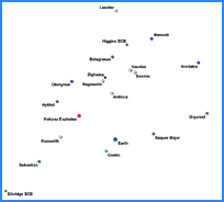
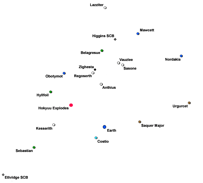
No attempt has been made to show the
thousands of stars, planets, and moons
in this small part of Galactic Alliance
space. The only purpose in presenting
this two-dimensional image is to provide
the reader with a feel for the spatial
relationship between the bases, systems,
and celestial events referenced in the
first three books of the AGU series.
In order to better comprehend the
expanse involved, the mean distance from
Earth to Higgins Space Command Base has
been computed as being 90.1538
light-years.
|
|
|
|
All image formats can be
magnified substantially once you've downloaded
them, but the pdf images yield far better
results at extreme magnification.
|
|
|
|
.jpg
(42 kb)
|
.pdf
(1,038 kb) |
|
|
This two-dimensional image shows
Galactic Alliance borders after the expansion
that occurs in Book 4, Trader Vyx. I've found
that using a 550% magnification factor with the
pdf version allows me to read the planet and
base names with utmost clarity, but your results
may vary depending upon your computer's graphics
card and monitor. You may have to do a little
experimentation with the magnification
percentage.
|
|
|
 |
|
|
|
|
.jpg
(2,219 kb) |
.pdf
(2,215 kb) |
|
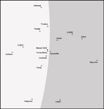
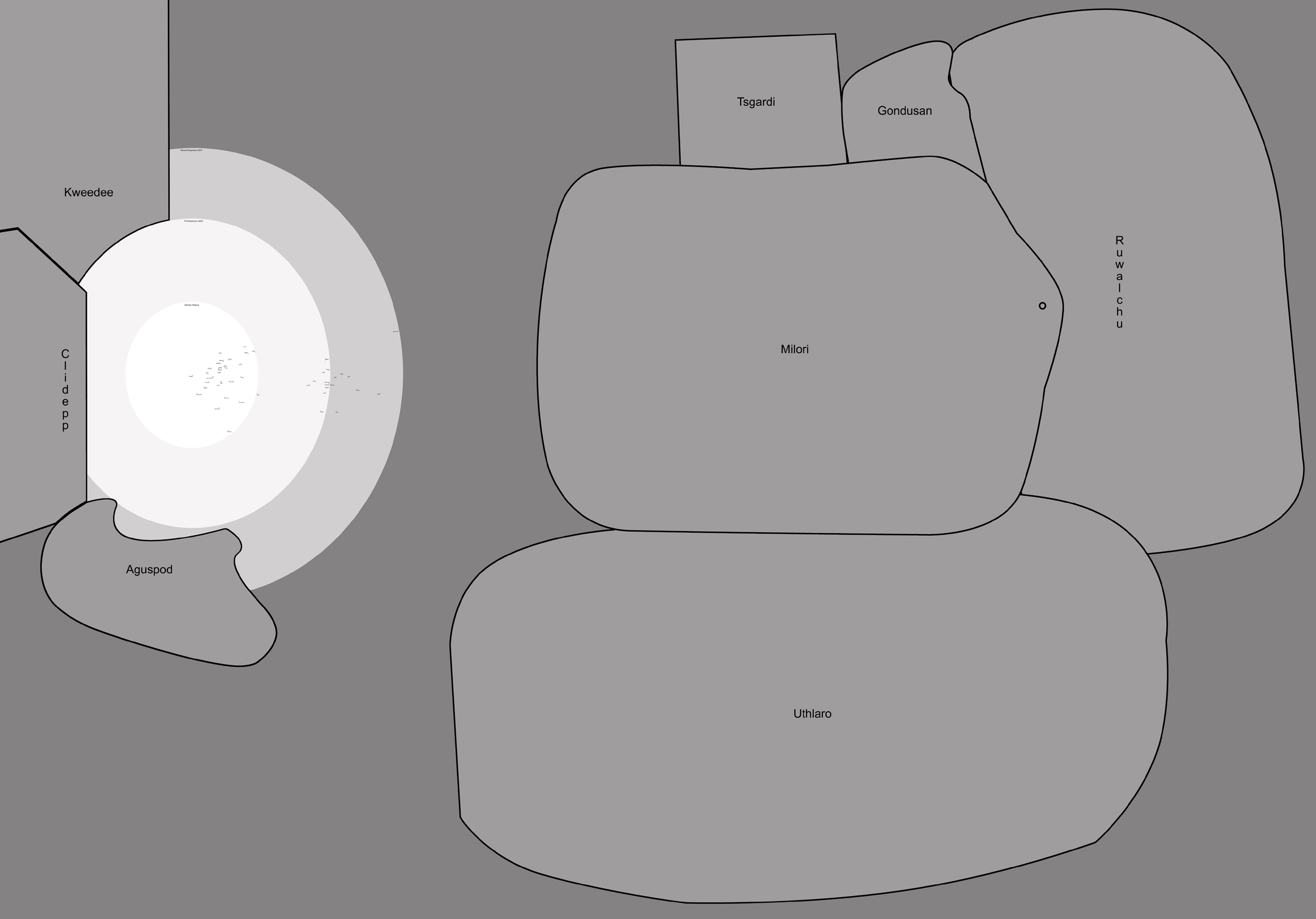
This image shows the territorial
assignments of various StratCom bases. The base
commander is responsible for all actions within
those borders. Stewart SCB is the only base
located in the former Frontier Zone. That fact,
along with its proximity to the new Zone, is
responsible for its much larger area of
coverage. The depth has been decreased as
partial compensation, and that area is the
responsibility of the base commander at Higgins
SCB.
The area bounded by a black square is the
immediate deca-sectors around Stewart SCB. An
enlarged image of that area can be viewed
immediately below this image.
|
|
|
 |
|
|
|
|
.jpg
(2,586 kb) |
.pdf
(2,580 kb) |
|
|
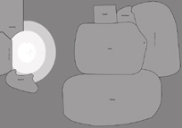
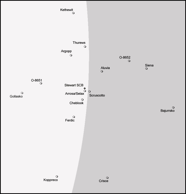
The deca-sectors around Stewart
SCB. Most of the planets and bases referenced in
Books 4 through 6 can be identified in this
image.
|
|
|
 |
|
|
|
|
.jpg
(80 kb) |
.pdf
(78 kb) |
|
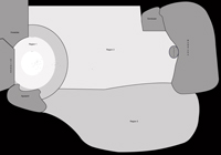
A map showing Region One and
Region Two before the Milori invaded Galactic
Alliance space.
The size of this map means
that individual planet, moon, and base identifications
are not easily readable when enlarged. I suggest you use
the previous, smaller maps to identify locations
|
|
|
 |
|
|
|
|
.jpg
(430 kb) |
.pdf
(9,757 kb) |
|
|
A map showing Region One, Two,
and Three after the war with the THUG pact has
ended. The unclaimed space between the
territories has been claimed by the Galactic
Alliance. |
|
|
 |
|
|
|
|
.jpg
(2,244 kb) |
.pdf
(9,540 kb) |
|
